Hydrographic & Bathymetric Surveying
Precision seabed and underwater terrain mapping for marine, coastal, and infrastructure projects.
Accurate Underwater Surface Models for Marine Projects
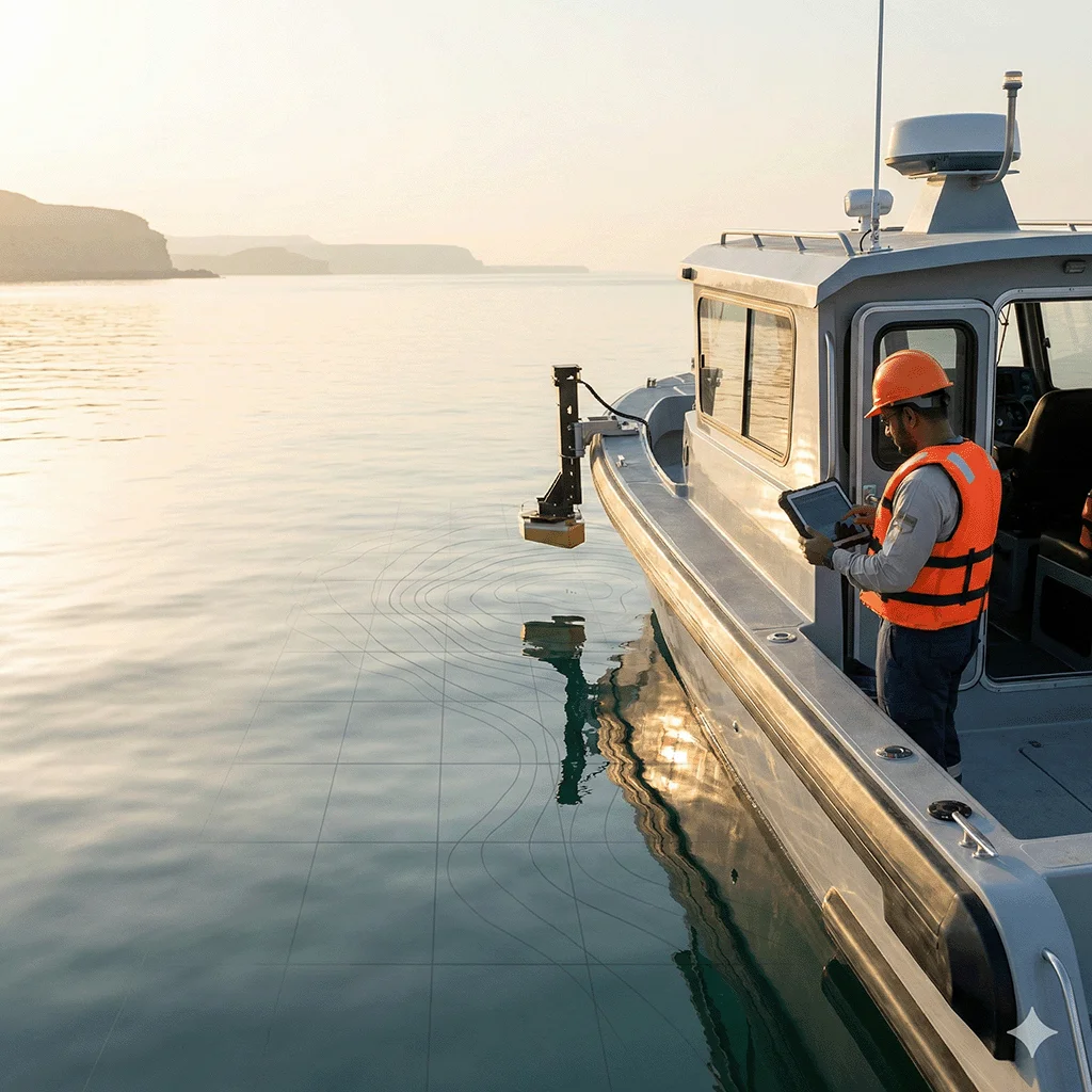
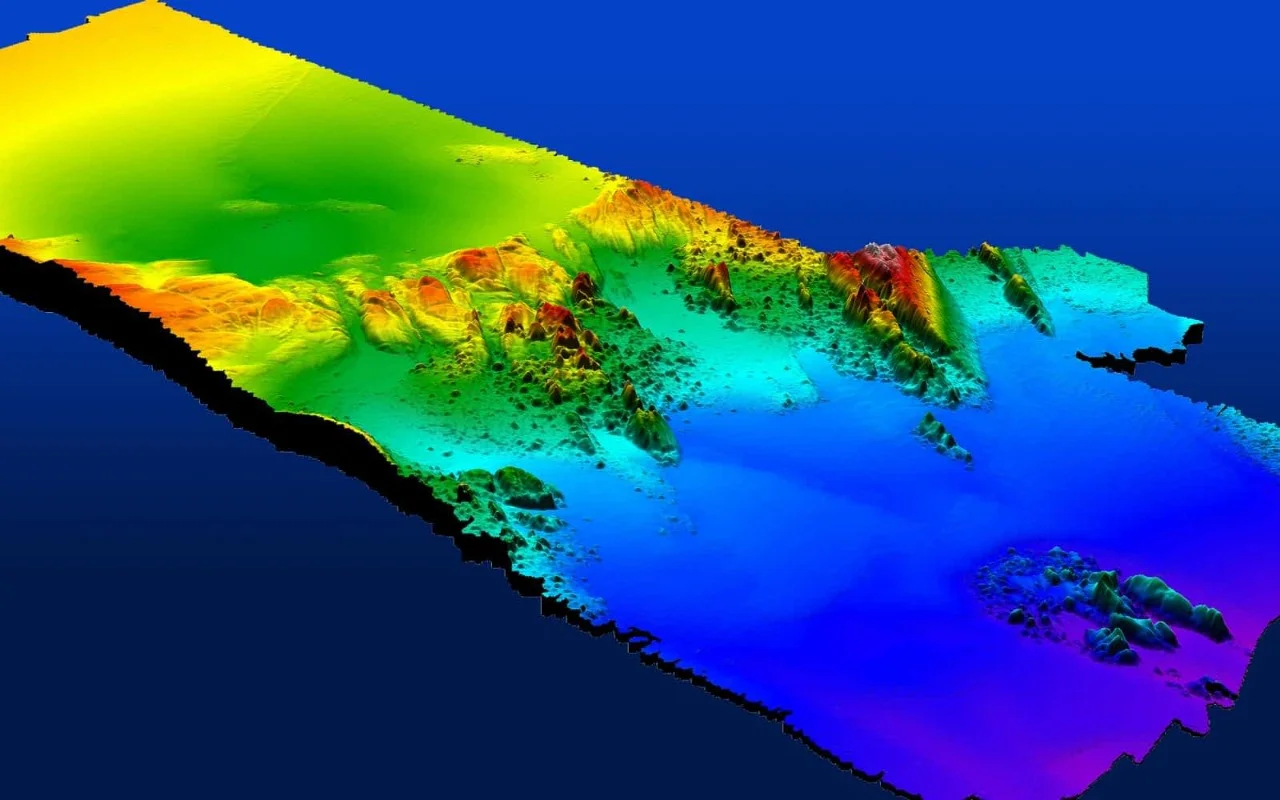
Hydrographic and bathymetric surveys measure water depths, seabed profiles, and submerged features using calibrated single-beam and multi-beam echo sounder systems. These surveys support port development, dredging operations, reclamation works, and marine infrastructure planning by providing accurate underwater surface models.
Our Methodology
Delivering excellence through a proven three-stage workflow
Control & Calibration Setup
Establishment of horizontal and vertical control, tide monitoring, and equipment calibration prior to survey execution.
Sonar Data Acquisition
Collection of depth data using single-beam or multi-beam systems integrated with GNSS positioning.
Processing & Surface Modeling
Tidal correction, data cleaning, seabed modeling, and validation before final chart production.
Applications
Industry sectors and use cases we serve
Port & Marina Development
Assesses seabed depth and underwater conditions for dock expansion and marine structures
Dredging Operations
Verifies excavation levels and calculates dredged volumes
Coastal Reclamation
Supports fill estimation and shoreline profiling
Subsea Pipeline & Marine Infrastructure
Maps underwater alignments and crossing profiles
Deliverables
What you receive at the end of every project
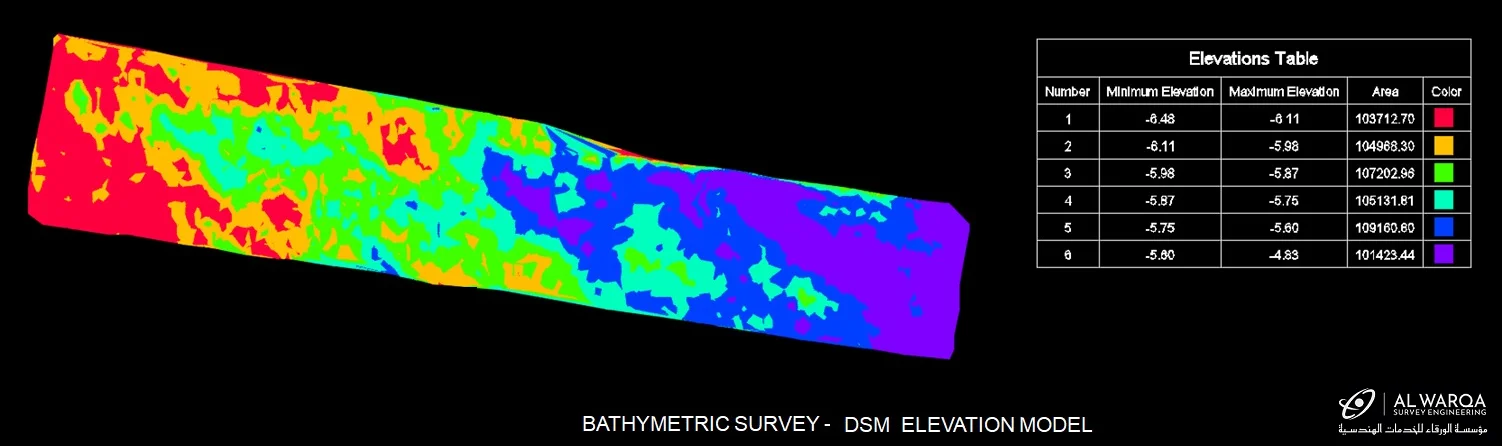
- Bathymetric surface models (DTM)
- Digital seabed terrain models
- Depth contour maps
- Longitudinal and cross-section profiles
- Dredge volume calculations
- Hydrographic charts
- XYZ data files
- GIS layersSHP / Geodatabase
- Survey report with tidal corrections and accuracy statement
Technology Stack
Industry-leading equipment and software
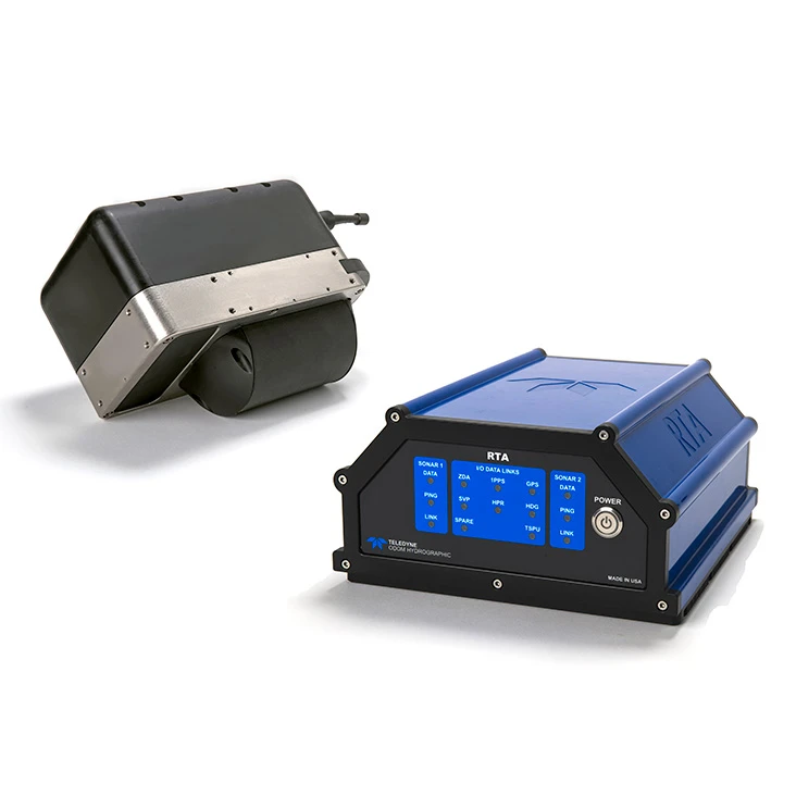
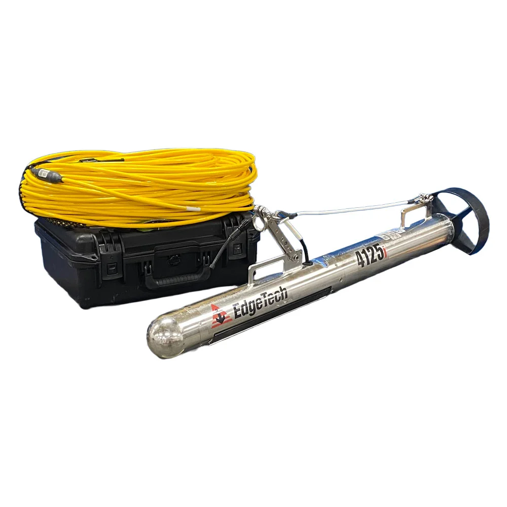
Single & Multi-Beam Echo Sounders
Advanced surveying technology for precision data capture and analysis.
Side-Scan Sonar
Advanced surveying technology for precision data capture and analysis.

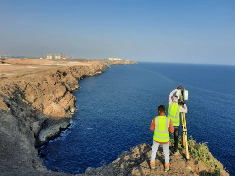
GNSS RTK Positioning
Advanced surveying technology for precision data capture and analysis.
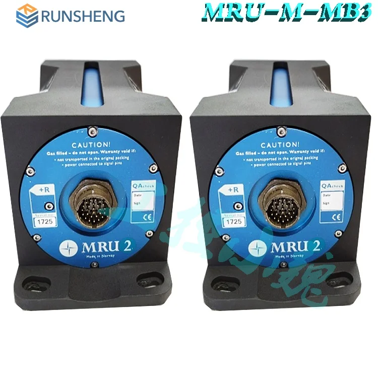
Motion Reference Units
Advanced surveying technology for precision data capture and analysis.

Hypack / EIVA NaviPac
Advanced surveying technology for precision data capture and analysis.
Frequently Asked Questions
Our surveys achieve vertical accuracy of ±10-20cm and horizontal accuracy of ±0.5-1m, meeting IHO S-44 standards for Order 1 surveys.
We install temporary tide gauges or use real-time tidal modeling, and all depths are reduced to a common chart datum (e.g., Mean Sea Level or Lowest Astronomical Tide).
Yes, we deploy different equipment for shallow water (single-beam sonar, lead lines) and can safely operate near jetties, platforms, and coastal structures.
For dredging, we provide pre- and post-dredge surveys, volume calculations, cross-sections, and compliance reports showing achieved depths vs. design.
Have more questions?
Our team of experts is ready to assist you with your specific project requirements across the GCC.
Related Services
Explore our other professional surveying solutions
Topographic & Terrain Mapping
High-accuracy terrain and elevation mapping for infrastructure, development, and engineering projects.
As-Built Surveys (3D Laser Scanning-Based)
High-accuracy 3D laser scanning for documentation and verification of existing building structures, including slab levels, core walls, and structural geometry.
GIS & Geospatial Solutions
Structured geospatial data management, mapping, and spatial analysis services for infrastructure and asset systems.
Contact us directly
Reach our team instantly via WhatsApp, phone, or email.
Also available in Riyadh